SatFinder is a mobile tool designed specifically for mobile devices. Users need to enable GPS positioning and a network connection on their device. Based on the user's location and the built-in compass tool, it finds nearby satellite data and locations, then displays the satellite's azimuth and elevation values, ensuring users can understand the satellite's path in real time. The software has built-in data from over 150 satellites in different locations, and more satellite data and positioning technologies are constantly being updated to better help users display satellite images and locations, meeting diverse user needs.
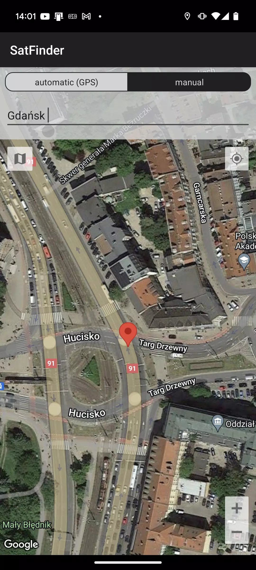
First of all, you should enable GPS and Internet on your phone. Remember – in most cases it is impossible to receive GPS signal inside buildings. So if you want to get very accurate location – please go near windows or go even outside.In current app version location should be found quite immediately. So if you stuck with ‘no location’ message please make ensure that you got enabled all required features/permissions.
If app found your location, you must select desired satellite. To do this you must find icon with magnification glass and tap it. On the list you will find all satellites with elevation angle above zero degrees. Remember: satellite name doesn’t affect the calculation of angles. Important thing is satellite position.
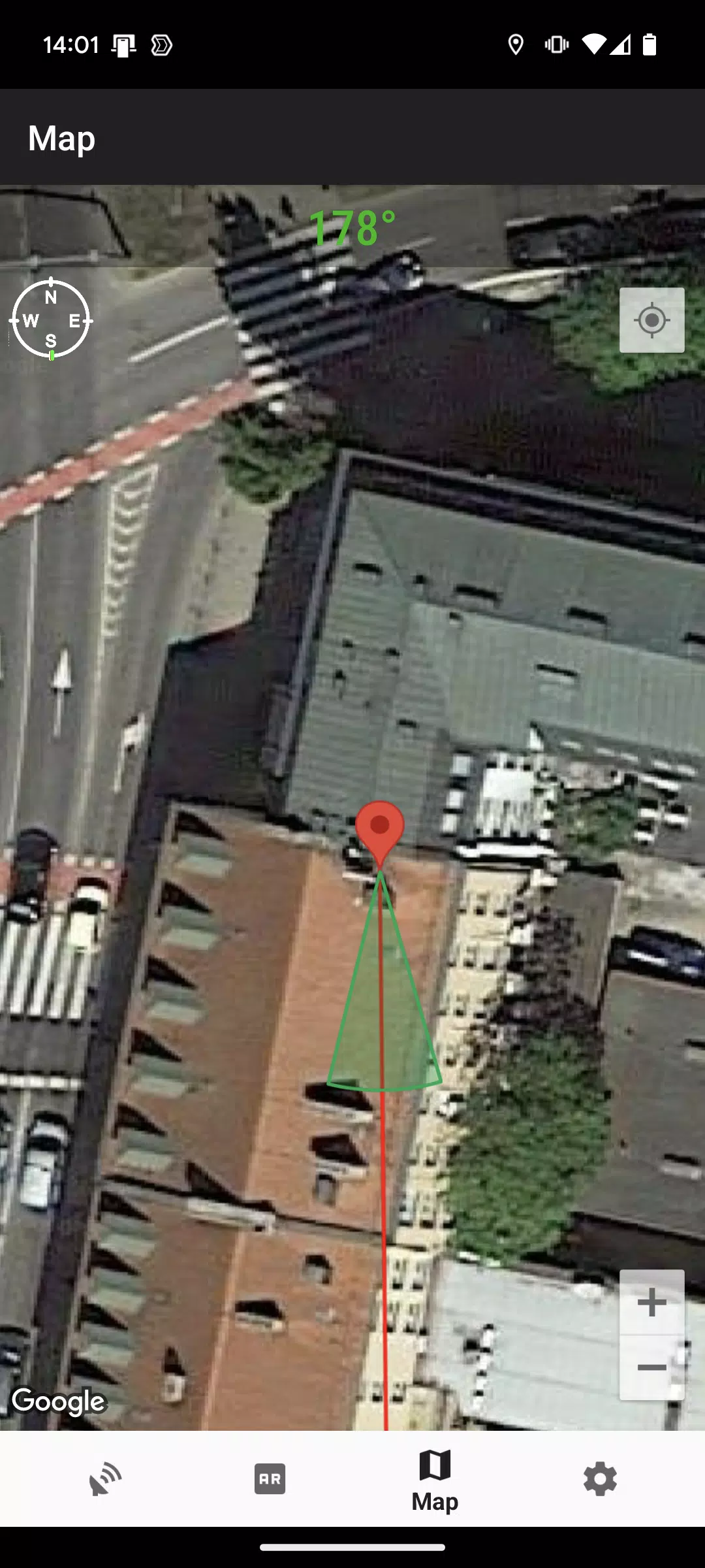
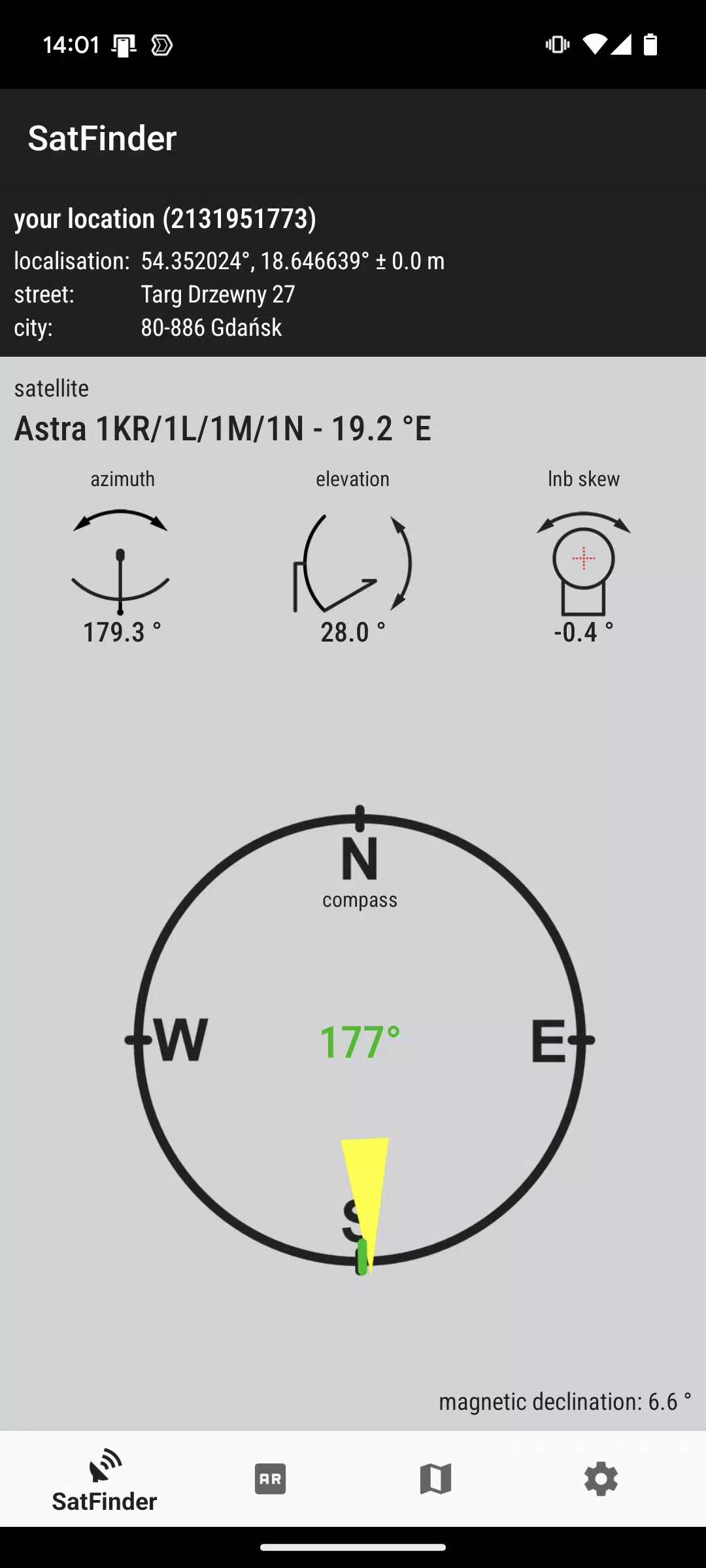
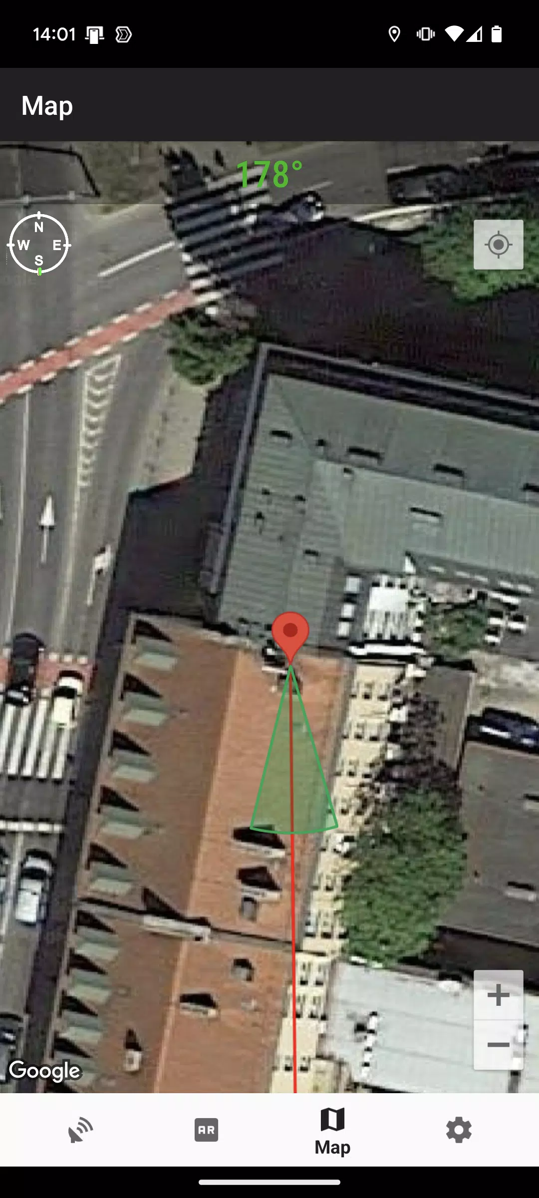
The azimuth, elevation and skew angle is calculated for your location and chosen satellite. Under calculated values there is a compass with graphical representation of azimuth angle. The azimuth angle is calculated with magnetic inclination. Remember – every time you use compass – you should calibrate it. Green line represents your phone azimuth. So if on compass green and red indicators are on each other – front of the phone should show you direction to the satellite. If the compass value is correct – phone azimuth value will go green.
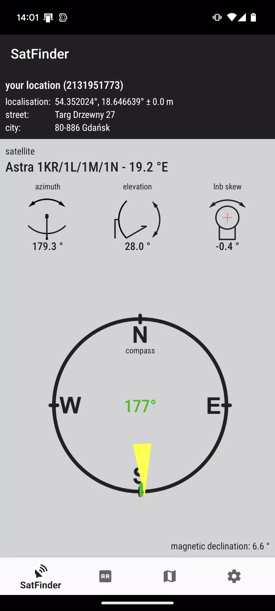
The app provides a comprehensive database containing more than 150 satellites available worldwide, allowing users to select their desired satellite for setup. Upon selection, the application offers precise azimuth and elevation values that guide the user in aligning their satellite dish correctly. This feature ensures that users can receive a strong signal by pointing their dish in the right direction.
To enhance the user experience, Satfinder incorporates a satellite view that displays the location of satellites above the user's current position. This visual representation aids users in adjusting their dish accordingly. The app also includes a level meter and direction finder, which are essential for ensuring that the satellite dish is not only pointed in the correct direction but is also level and stable.
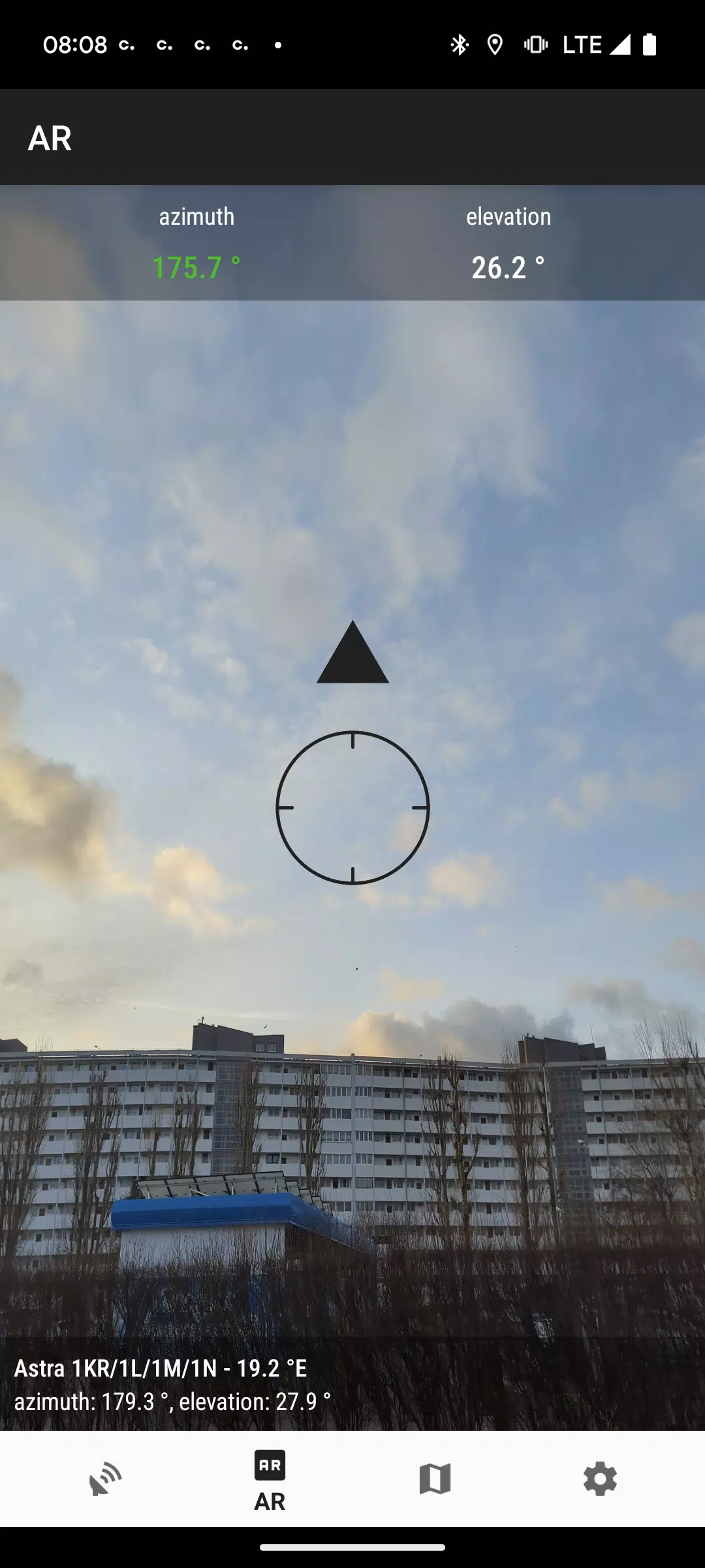
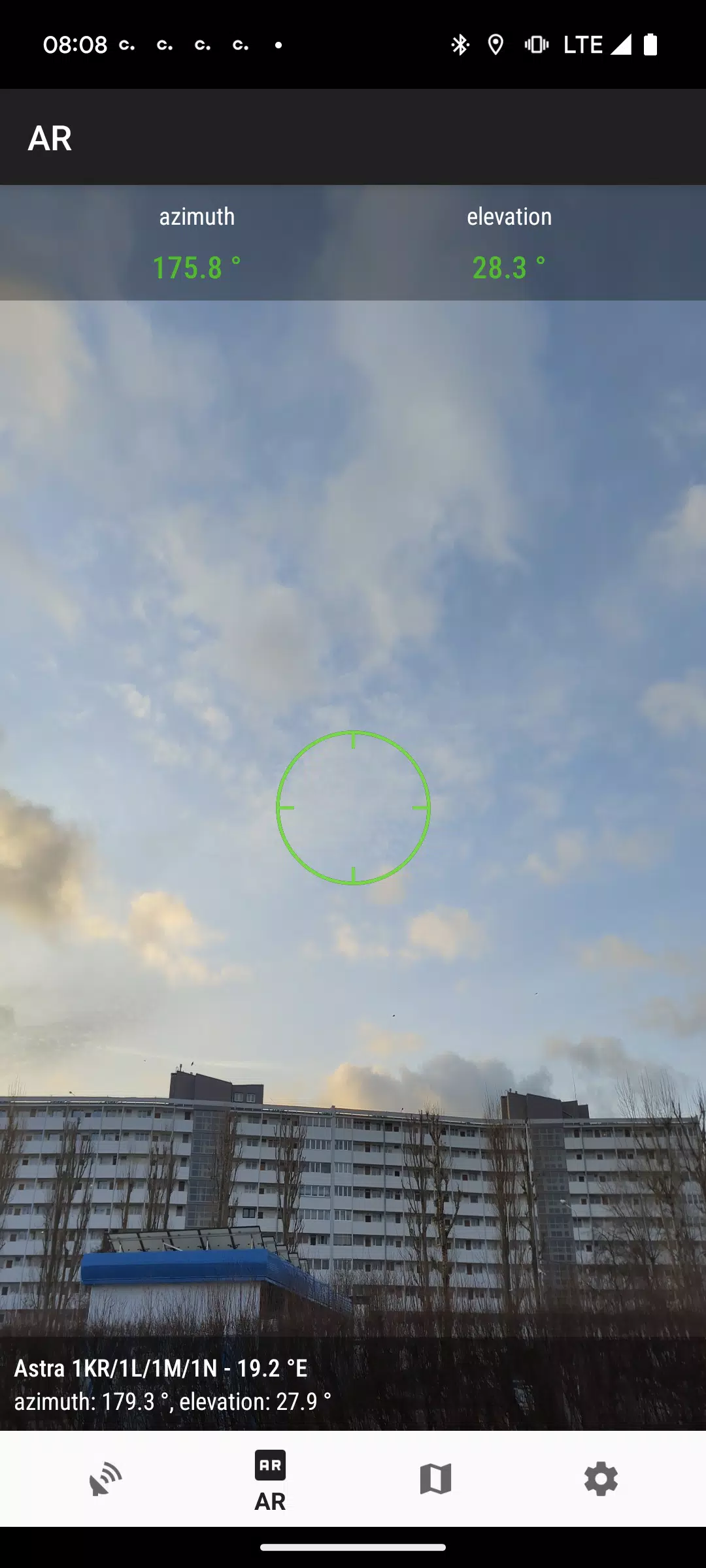
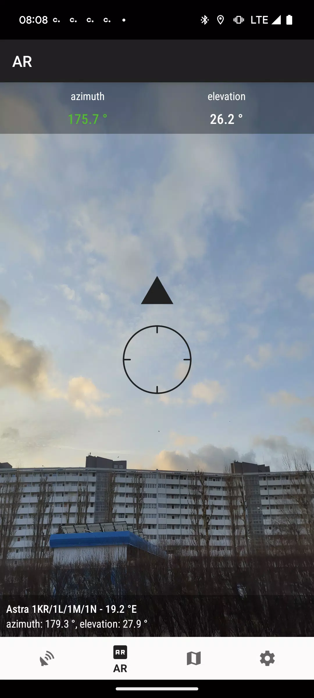
A standout feature of the Satfinder app is its augmented reality capability. This innovative technology allows users to utilize their device's camera to view the satellite positioning in real time. By using the augmented reality feature, individuals can visually determine the path to the satellite, making the setup process more intuitive and effective.
The application also integrates a gyro compass, which is instrumental in guiding users about directions. This feature provides accurate information about the necessary angles for both azimuth and elevation, further easing the satellite dish alignment process. The gyro compass is particularly beneficial in areas where traditional compass readings may be less reliable.
In addition to its primary function of helping with dish alignment, Satfinder: Satellite Director serves as a frequency finder for satellite channels. Users can access a list of satellite channels along with their associated frequencies, which is essential for configuring satellite receivers and ensuring optimal channel reception.
A satfinder app doesn’t detect radio signals. Instead, it calculates geometric satellite position relative to your location using three core inputs:
GPS Coordinates: Latitude/longitude from your phone’s GNSS chip (typically ±3–5 m accuracy). Apps like DishPointer let you manually enter coordinates if GPS is unreliable indoors or under dense canopy.
Satellite Orbital Data: Updated Two-Line Element (TLE) sets or geostationary orbital slots (e.g., 19.2°E for Astra, 28.2°E for Hotbird). Most apps bundle static databases; premium versions (e.g., Satellite Finder Pro) auto-sync TLEs for low-earth orbit (LEO) objects like Starlink or ISS4.
Device Orientation Sensors: Magnetometer (compass), accelerometer, and gyroscope fused to determine true north, pitch, and roll. This is where most failures occur — uncalibrated compasses drift up to ±20°, causing misalignment even with perfect GPS.
From these, the app computes:
Azimuth: Horizontal compass bearing (0° = true north, 90° = east) — critical for left/right dish rotation.
Elevation: Vertical angle above horizon (0° = flat, 90° = straight up) — controls dish tilt.
LNB Skew (Tilt): Rotation of the feedhorn around its axis — essential for circular or linear polarization matching (e.g., 35° clockwise for Astra 28.2°E in London).
Note: Elevation and skew values change with latitude. An app showing 28° elevation for 19.2°E in Berlin will show 37° for the same satellite in Rome — because geometry differs. Never reuse angles across locations.
Using the Azimuth angle, it'll be easy to install your satellite dish without too many problems. It's all thanks to the clear instructions found in this productive app. If you don't know much about the technical installations of antennas, SatFinder is guaranteed to be a huge help.
Size:37MB Version:1.50
Requirements:Android Votes:458
Package Name:com.esys.satfinder Signature:71cc9d356ce865f5febe70b89cf463e777199e08
Transform your mobile device into a powerhouse of efficiency with these handpicked essential tools. Whether you need professional-grade photo editing, seamless file organization, smart task management, or real-time weather updates, our curated selection of premium apps delivers unbeatable performance. Streamline your daily routine, automate repetitive tasks, and boost your productivity with intuitive interfaces and powerful features. Designed for both professionals and casual users, these editor-approved applications will revolutionize how you work and play. Don't settle for an ordinary phone - upgrade your digital experience today and unlock your device's full potential!
With the development of mobile hardware and software, many practical tool software have emerged, covering a wide range of aspects and becoming a good helper for everyone in work and life. Today, the editor provides you with a list of useful tool software downloads. These tools are not particularly complex types, and after reading them, everyone can quickly learn how to use them. Proper use can bring great convenience to life and work.
About us | Contact us | Privacy policy| DMCA
Copyright © 2026 Xiaohei All rights reserved.